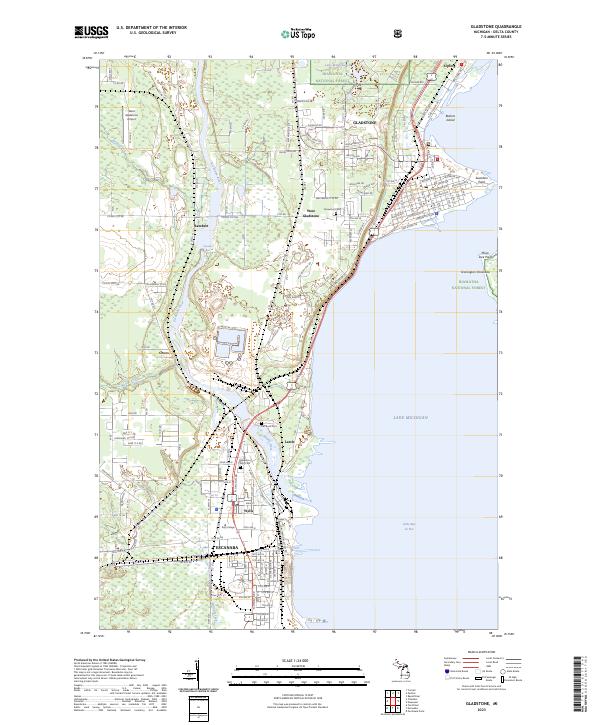
2023 Map of Gladstone
USGS Topo · Published 2023About this map
Gladstone and the northern reaches of Escanaba dominate this coastal survey of Delta County, where the Escanaba River meets Lake Michigan. The landscape is defined by the industrial and academic foundations of the region, including the campus of Bay College and a coastal Power Plant situated near Wells. The topography transitions from the dense woodlands of the Hiawatha National Forest to the marshy lowlands surrounding Bichler Creek and Reno Creek.
Find a feature on this map
83 named features on this map. Tap any name to fly to it.
Don’t see what you’re looking for? This feature index may not catch every label — zoom into the map to look around manually.
Map Details
Editions of this 2023 Gladstone Map
This is the sole edition of this map. No revisions or reprints were ever made.
Other maps of this area

1932 · Gladstone NE
USGS Topo · 1:31,680

1932 · Gladstone SE
USGS Topo · 1:31,680

1932 · Rapid River NW
USGS Topo · 1:31,680

1932 · Rapid River SW
USGS Topo · 1:31,680

1932 · Gladstone SW
USGS Topo · 1:31,680

1932 · Gladstone NW
USGS Topo · 1:31,680

1950 · Gladstone NW
USGS Topo · 1:31,680

1954 · Escanaba
USGS Topo · 1:250,000

1957 · Escanaba
USGS Topo · 1:250,000

1958 · Escanaba
USGS Topo · 1:250,000