
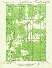
1932 Map of Gladstone SW
USGS Topo · Published 1932About this map
Ford River and the Escanaba river system define the landscape of this Delta County quadrangle, captured during field examinations in the early 1930s. The region is characterized by a network of rural schoolhouses, including Lincoln Sch in the north and Danforth Sch further south, suggesting a distributed farming or logging community during this era. The small settlement of Flatrock serves as a local hub, anchored by the Holy Family Ch.
Find a feature on this map
18 named features on this map. Tap any name to fly to it.
Don’t see what you’re looking for? This feature index may not catch every label — zoom into the map to look around manually.
Map Details
Editions of this 1932 Gladstone SW Map
2 editions found
Other maps of this area

1932 · Gladstone NE
USGS Topo · 1:31,680

1932 · Gladstone SE
USGS Topo · 1:31,680

1932 · Bark River NE
USGS Topo · 1:31,680

1932 · Whitney NE
USGS Topo · 1:31,680

1932 · Whitney SE
USGS Topo · 1:31,680

1932 · Gladstone NW
USGS Topo · 1:31,680

1950 · Gladstone NW
USGS Topo · 1:31,680

1954 · Escanaba
USGS Topo · 1:250,000

1957 · Escanaba
USGS Topo · 1:250,000

1958 · Escanaba
USGS Topo · 1:250,000