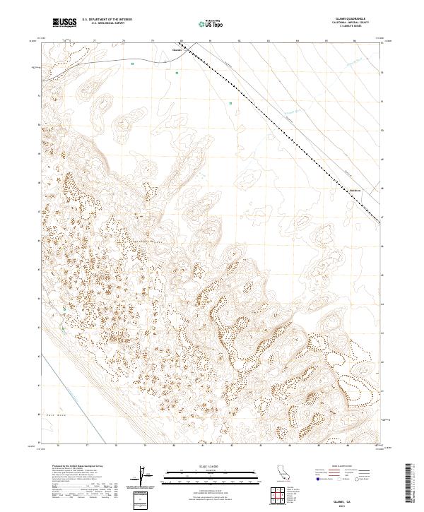
2021 Map of Glamis
USGS Topo · Published 2021About this map
Algodones Dunes dominate the topography of this corner of the Imperial Valley, where the shifting sands of southeastern California create a distinctive desert landscape. The small settlement of Glamis sits at the intersection of the railway and the northern edge of these dunes, serving as a focal point in a region defined by vast open spaces and ephemeral drainage systems like Ninemile Wash. To the southeast, Ruthven marks another point of interest along the transportation corridor that cuts diagonally through the desert. On the western edge of the dunes, the transition to the East Mesa is marked by the vital infrastructure of the Coachella Canal, which brings water into this arid environment. The map details the grid of the Public Land Survey System, showing how the desert is organized into townships and ranges even where permanent human habitation is sparse, linked by remote tracks such as Ted Kipf Rd.
Find a feature on this map
14 named features on this map. Tap any name to fly to it.
Don’t see what you’re looking for? This feature index may not catch every label — zoom into the map to look around manually.
Map Details
Editions of this 2021 Glamis Map
This is the sole edition of this map. No revisions or reprints were ever made.
Other maps of this area

1903 · Yuma
USGS Topo · 1:125,000

1905 · Yuma
USGS Topo · 1:125,000

1907 · Holtville
USGS Topo · 1:125,000

1942 · El Centro
USGS Topo · 1:250,000

1942 · Yuma
USGS Topo · 1:250,000

1942 · Blythe
USGS Topo · 1:250,000

1953 · Quartz Peak
USGS Topo · 1:62,500

1953 · Ogilby
USGS Topo · 1:62,500

1953 · Cactus
USGS Topo · 1:24,000

1953 · Acolita
USGS Topo · 1:24,000