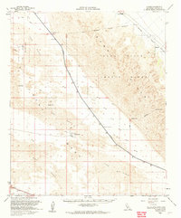
1955 Map of Glamis
USGS Topo · Published 1961About this map
Coachella Canal cuts a sharp line across the arid landscape of Imperial County in this mid-century survey, separating the sweeping Sand Dunes from the technical infrastructure of the desert. The Southern Pacific railroad parallels the canal, serving the small stops of Glamis and Ruthven. This era represents a period of significant military and water-management activity, evidenced by the large Naval Reservation and a remote Landing Strip. Local movement is traced through a network of Jeep Trails that navigate around landmarks like Deer Peak. The map provides specific engineering details for the time, such as the Gaging Sta, Coachella Bridge No 1, and Coachella Bridge No 2, which were vital for managing resources in this environment during the late 1950s.
Find a feature on this map
14 named features on this map. Tap any name to fly to it.
Don’t see what you’re looking for? This feature index may not catch every label — zoom into the map to look around manually.
Map Details
Editions of this 1955 Glamis Map
2 editions found
Other maps of this area

1903 · Yuma
USGS Topo · 1:125,000

1905 · Yuma
USGS Topo · 1:125,000

1907 · Holtville
USGS Topo · 1:125,000

1940 · Iris
USGS Topo · 1:62,500

1940 · Alamorio
USGS Topo · 1:62,500

1940 · Calexico
USGS Topo · 1:62,500

1942 · El Centro
USGS Topo · 1:250,000

1942 · Yuma
USGS Topo · 1:250,000

1942 · Blythe
USGS Topo · 1:250,000

1943 · Calexico
USGS Topo · 1:62,500