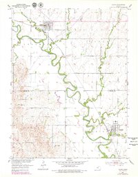
1952 Map of Glasco
USGS Topo · Published 1979About this map
The Solomon River meanders across the Kansas plains, anchoring the agricultural settlements of Glasco and Delphos during the mid-20th century. The landscape is defined by the Union Pacific rail line and a network of creeks including Fisher Creek, Cris Creek, and Mortimer Creek. The river's winding path through Sheridan and Stanton townships created a fertile but challenging terrain for early surveying, evidenced by the numerous benchmarks and the Pumping Station situated near the water's edge.
Find a feature on this map
24 named features on this map. Tap any name to fly to it.
Don’t see what you’re looking for? This feature index may not catch every label — zoom into the map to look around manually.
Map Details
Editions of this 1952 Glasco Map
2 editions found
Other maps of this area

1892 · Minneapolis
USGS Topo · 1:125,000

1952 · Glasco SW
USGS Topo · 1:24,000

1952 · Glasco
USGS Topo · 1:24,000

1953 · Glasco NE
USGS Topo · 1:24,000

1953 · Simpson
USGS Topo · 1:24,000

1955 · Manhattan
USGS Topo · 1:250,000

1956 · Manhattan
USGS Topo · 1:250,000

1957 · Manhattan
USGS Topo · 1:250,000

1961 · Tescott NE
USGS Topo · 1:24,000
1964 · Ada
USGS Topo · 1:24,000