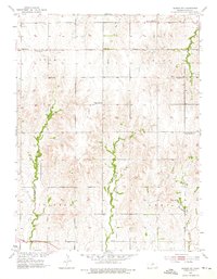
1953 Map of Glasco NE
USGS Topo · Published 1976About this map
The small settlement of Macyville sits at the heart of this mid-century survey of Cloud County, Kansas. The landscape is characterized by a high density of rural institutions that suggest a well-established agrarian society even as demographic shifts began to emerge. Multiple educational sites, including Highland Sch, Silver Arrow Sch, and Fairview Sch, are spaced across the townships of Summit, Arion, Solomon, and Lyon. Notably, the map records the transition of the local school system, marking both the Range Line Sch (Abandoned) and Prairie Point Sch (Abandoned) as no longer in use.
Find a feature on this map
17 named features on this map. Tap any name to fly to it.
Don’t see what you’re looking for? This feature index may not catch every label — zoom into the map to look around manually.
Map Details
Editions of this 1953 Glasco NE Map
3 editions found
Other maps of this area

1892 · Concordia
USGS Topo · 1:125,000

1892 · Minneapolis
USGS Topo · 1:125,000

1952 · Glasco SW
USGS Topo · 1:24,000

1952 · Glasco
USGS Topo · 1:24,000

1953 · Glasco NE
USGS Topo · 1:24,000

1953 · Simpson
USGS Topo · 1:24,000

1955 · Manhattan
USGS Topo · 1:250,000

1956 · Manhattan
USGS Topo · 1:250,000

1957 · Manhattan
USGS Topo · 1:250,000
1965 · Aurora SW
USGS Topo · 1:24,000