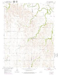
1952 Map of Glasco SW
USGS Topo · Published 1979About this map
The Solomon River meanders across the northern reaches of this landscape, its path shadowed by the Union Pacific rail line. This rural Kansas intersection where Mitchell, Cloud, and Ottawa counties meet is defined by a series of sequential watercourses, from First Creek in the east to Fourth Creek in the northwest, which drain the surrounding agricultural uplands.
Find a feature on this map
19 named features on this map. Tap any name to fly to it.
Don’t see what you’re looking for? This feature index may not catch every label — zoom into the map to look around manually.
Map Details
Editions of this 1952 Glasco SW Map
2 editions found
Other maps of this area

1892 · Minneapolis
USGS Topo · 1:125,000

1894 · Beloit
USGS Topo · 1:125,000

1952 · Glasco SW
USGS Topo · 1:24,000

1952 · Glasco
USGS Topo · 1:24,000

1953 · Glasco NE
USGS Topo · 1:24,000

1953 · Simpson
USGS Topo · 1:24,000

1953 · Beloit
USGS Topo · 1:24,000

1955 · Manhattan
USGS Topo · 1:250,000

1955 · Beloit
USGS Topo · 1:250,000

1956 · Manhattan
USGS Topo · 1:250,000