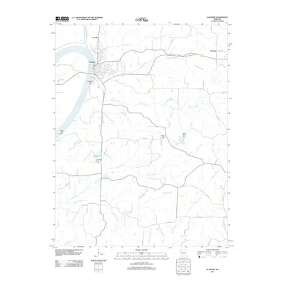
2012 Map of Glasgow
USGS Topo · Published 2012About this map
Glasgow and the surrounding Howard County countryside are defined by the wide curves of the Missouri River, which forms the prominent Glasgow Bend and the Bluff Port Reach to the southwest. This 2012 map shows the town's street grid, including 10th ST and 15th ST, transitioning into a landscape of rural roads like Old HWY 87. The area's hydrology is complex, with the Little Chariton River joining the Missouri near Louisville, and numerous drainage systems including Bear Creek, Greggs Creek, and Hurricane Creek carving through the terrain.
Find a feature on this map
54 named features on this map. Tap any name to fly to it.
Don’t see what you’re looking for? This feature index may not catch every label — zoom into the map to look around manually.
Map Details
Editions of this 2012 Glasgow Map
This is the sole edition of this map. No revisions or reprints were ever made.
Other maps of this area

1890 · Glasgow
USGS Topo · 1:125,000

1947 · Glasgow
USGS Topo · 1:62,500

1952 · New Franklin
USGS Topo · 1:24,000

1953 · Moberly
USGS Topo · 1:250,000

1953 · Fayette
USGS Topo · 1:24,000

1953 · Armstrong
USGS Topo · 1:24,000

1954 · Moberly
USGS Topo · 1:250,000
1956 · Forest Green
USGS Topo · 1:24,000
1956 · Cambridge
USGS Topo · 1:24,000

1957 · Moberly
USGS Topo · 1:250,000