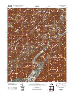
2011 Map of Glasgow
USGS Topo · Published 2011About this map
The Maury River and James River converge at Glasgow, a riverfront settlement defined by its proximity to the water and the surrounding peaks of the Blue Ridge. In the early 21st century, this landscape preserves several small communities and industrial sites, including Buffalo Forge and the Lone Jack Quarry. The area is rich in family history, evidenced by numerous burial grounds such as the Salling Family Cemetery, Mount Lidia Cemetery, and Paxton Cemetery.
Find a feature on this map
101 named features on this map. Tap any name to fly to it.
Don’t see what you’re looking for? This feature index may not catch every label — zoom into the map to look around manually.
Map Details
Editions of this 2011 Glasgow Map
This is the sole edition of this map. No revisions or reprints were ever made.
Other maps of this area

1894 · Natural Bridge
USGS Topo · 1:125,000

1894 · Lexington
USGS Topo · 1:125,000

1894 · Natural Bridge
USGS Topo · 1:62,500

1907 · Natural Bridge Special
USGS Topo · 1:62,500

1932 · Lexington
USGS Topo · 1:48,000

1935 · Buena Vista
USGS Topo · 1:48,000

1937 · Lexington
USGS Topo · 1:62,500

1939 · Buena Vista
USGS Topo · 1:62,500

1940 · Buena Vista
USGS Topo · 1:62,500

1946 · Millboro
USGS Topo · 1:62,500