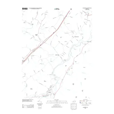
2013 Map of Glasgow
USGS Topo · Published 2013About this map
Glasgow sits at the strategic confluence where the Maury River meets the James River, a location historically defined by its water-gap geography. This modern survey illustrates the town's grid settled against the base of Sallings Mountain, with the B G Locher Bridge providing a vital crossing point. To the north, the landscape transitions from the river flats to the rising elevations of Miller Mountain and Round Hill. The influence of the area's agricultural and industrial heritage is evident in place names like Buffalo Forge and Buffalo Bend, while smaller communities such as Mechanicsville and Fancy Hill dot the corridors leading toward the Blue Ridge. The terrain is notably defined by dramatic peaks like Big Rocky Row and Little Rocky Row, which overlook the deep river valleys that have channeled transportation through this part of Virginia for generations.
Find a feature on this map
127 named features on this map. Tap any name to fly to it.
Don’t see what you’re looking for? This feature index may not catch every label — zoom into the map to look around manually.
Map Details
Editions of this 2013 Glasgow Map
This is the sole edition of this map. No revisions or reprints were ever made.
Other maps of this area

1894 · Natural Bridge
USGS Topo · 1:125,000

1894 · Lexington
USGS Topo · 1:125,000

1894 · Natural Bridge
USGS Topo · 1:62,500

1907 · Natural Bridge Special
USGS Topo · 1:62,500

1932 · Lexington
USGS Topo · 1:48,000

1935 · Buena Vista
USGS Topo · 1:48,000

1937 · Lexington
USGS Topo · 1:62,500

1939 · Buena Vista
USGS Topo · 1:62,500

1940 · Buena Vista
USGS Topo · 1:62,500

1946 · Millboro
USGS Topo · 1:62,500