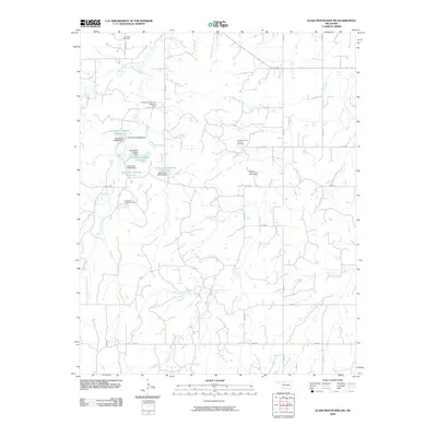
2009 Map of Glass Mountains SW
USGS Topo · Published 2009About this map
Lone Star Cemetery marks the northwestern corner of this Oklahoma landscape, a region defined by its mid-century energy development and dispersed water management. The terrain is characterized by the expansive Northeast Cheyenne Valley Oil Field and the East Cheyenne Oil and Gas Field, indicating a rural economy deeply tied to subsurface resources. Surface water is carefully controlled through a network of dams and reservoirs, including the Oknoname 093008 Reservoir and Oknoname 093011 Reservoir, which sit alongside the natural drainage of Barney Creek. Near the center of the sheet, the prominent landmark of Tepee Mountain rises above the surrounding plains, while the winding course of Cheyenne Creek cuts through the southeastern sections. The map reveals a strictly gridded road system, including N2430 Rd and E0480 Rd, which provides access to the numerous oil fields and localized water features across Major County.
Find a feature on this map
30 named features on this map. Tap any name to fly to it.
Don’t see what you’re looking for? This feature index may not catch every label — zoom into the map to look around manually.
Map Details
Editions of this 2009 Glass Mountains SW Map
This is the sole edition of this map. No revisions or reprints were ever made.
Other maps of this area

1955 · Woodward
USGS Topo · 1:250,000

1958 · Woodward
USGS Topo · 1:250,000

1969 · Phroso
USGS Topo · 1:24,000

1969 · Glass Mountains NW
USGS Topo · 1:24,000

1969 · Glass Mountains
USGS Topo · 1:24,000

1969 · Glass Mountains NE
USGS Topo · 1:24,000

1969 · Togo
USGS Topo · 1:24,000

1969 · Glass Mountains SW
USGS Topo · 1:24,000

1972 · Longdale
USGS Topo · 1:24,000

1972 · Canton NW
USGS Topo · 1:24,000