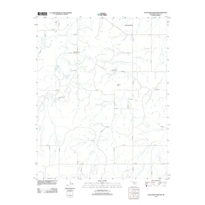
2012 Map of Glass Mountains SW
USGS Topo · Published 2012About this map
Cheyenne Valley serves as the central geographic feature of this Major County landscape, where the traditional ranching and farming terrain of western Oklahoma meets modern energy extraction. The intersection of natural topography and industrial development is evident in the presence of the Northeast Cheyenne Valley Oil Field, the East Cheyenne Oil and Gas Field, and the Cheyenne Valley Oil Field. These active sites are scattered across a network of section line roads including E0480 Rd and N2410 Rd. Local history is anchored by the Lone Star Cem in the northwest, providing a point of interest for genealogists tracing early families in the region. The area's drainage is defined by several waterways, most notably Barney Cr, its W Br Barney Cr, and Cheyenne Cr, which navigate the elevation changes near Tepee Mtn.
Find a feature on this map
30 named features on this map. Tap any name to fly to it.
Don’t see what you’re looking for? This feature index may not catch every label — zoom into the map to look around manually.
Map Details
Editions of this 2012 Glass Mountains SW Map
This is the sole edition of this map. No revisions or reprints were ever made.
Other maps of this area

1955 · Woodward
USGS Topo · 1:250,000

1958 · Woodward
USGS Topo · 1:250,000

1969 · Phroso
USGS Topo · 1:24,000

1969 · Glass Mountains NW
USGS Topo · 1:24,000

1969 · Glass Mountains
USGS Topo · 1:24,000

1969 · Glass Mountains NE
USGS Topo · 1:24,000

1969 · Togo
USGS Topo · 1:24,000

1969 · Glass Mountains SW
USGS Topo · 1:24,000

1972 · Longdale
USGS Topo · 1:24,000

1972 · Canton NW
USGS Topo · 1:24,000