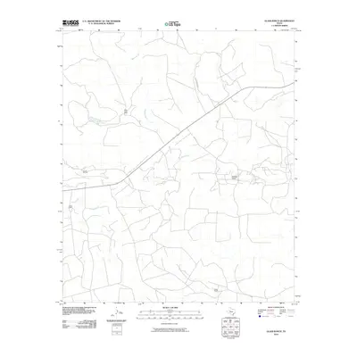
2010 Map of Glass Ranch
USGS Topo · Published 2010About this map
Glass Ranch and several other remote outposts define this corner of Sterling County, Texas, during the first decade of the 21st century. The landscape is characterized by a network of drainage ways and ranch roads, including Foster Ranch Rd and Bade Rd, which navigate the terrain around Bobs Creek and Lacy Creek. Petroleum extraction is a primary feature of the local economy, evident in the presence of the Herrell Oil Field in the west and the Parochial Bade Oil Field further east. These industrial sites are interspersed with established livestock operations like Bobs Creek Ranch and Shack Ranch, illustrating the dual land use of the region. The map provides a clear picture of the ranching and energy infrastructure that sustains this portion of the Permian Basin fringe.
Find a feature on this map
9 named features on this map. Tap any name to fly to it.
Don’t see what you’re looking for? This feature index may not catch every label — zoom into the map to look around manually.
Map Details
Editions of this 2010 Glass Ranch Map
This is the sole edition of this map. No revisions or reprints were ever made.
Other maps of this area

1954 · San Angelo
USGS Topo · 1:250,000

1958 · San Angelo
USGS Topo · 1:250,000

1963 · Cumbie Draw
USGS Topo · 1:24,000

1963 · Glass Ranch
USGS Topo · 1:24,000

1963 · Cumbie Draw NE
USGS Topo · 1:24,000

1963 · Currie Reservoir
USGS Topo · 1:24,000

1963 · Garden City NE
USGS Topo · 1:24,000
1963 · Sand Bluff Draw
USGS Topo · 1:24,000

1965 · San Angelo
USGS Topo · 1:250,000

1973 · Three Bluff Draw NE
USGS Topo · 1:24,000