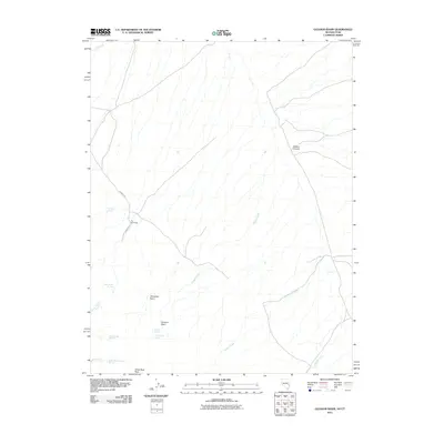
2011 Map of Gleason Basin
USGS Topo · Published 2011About this map
The Hermitage sits as the central landmark in this high-altitude landscape of the Nevada-Utah borderlands, where the terrain transitions between the namesake Gleason Basin and the higher elevations of White Rock Peak. The area is defined by its seasonal water sources, which were vital for livestock and early ranching, including the cluster of Milk Ranch Springs, Whiskey Spring, and the curiously named Lone Trough Spring. Drainages like Picketts Wash and Sawmill Creek cut through the arid basins, suggesting a history of resource extraction or grazing management. The presence of Johnson Rd and the Hermitage road indicate the primary routes of access through this remote section of Beaver County, connecting the scattered springs and basins like Alexander Basin to the wider region.
Find a feature on this map
18 named features on this map. Tap any name to fly to it.
Don’t see what you’re looking for? This feature index may not catch every label — zoom into the map to look around manually.
Map Details
Editions of this 2011 Gleason Basin Map
This is the sole edition of this map. No revisions or reprints were ever made.
Other maps of this area

1953 · Richfield
USGS Topo · 1:250,000

1956 · Lund
USGS Topo · 1:250,000

1958 · Richfield
USGS Topo · 1:250,000

1960 · Lund
USGS Topo · 1:250,000

1971 · Atchison Creek
USGS Topo · 1:24,000

1972 · Gleason Basin
USGS Topo · 1:24,000

1972 · Rosencrans Knolls
USGS Topo · 1:24,000

1972 · Hamlin Well
USGS Topo · 1:24,000

1972 · White Rock Peak
USGS Topo · 1:24,000
1972 · Lopers Spring
USGS Topo · 1:24,000