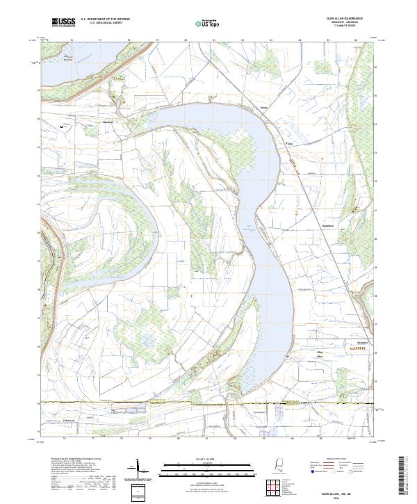
2024 Map of Glen Allan
USGS Topo · Published 2024About this map
Lake Washington dominates this oxbow landscape, a remnant of the Mississippi River which now forms the western boundary of Washington Co. Along its eastern shoreline, the small settlements of Glen Allan, Erwin, and Foote are connected by Westside Lake Washington Rd and Lake Washington Rd E. These hamlets reflect the enduring agricultural character of the Delta, situated on the fertile ground between the lake and the Yazoo National Wildlife Refuge to the east. The terrain is a network of water and levees, featuring Washington Bayou, Lake Jackson, and Byrne Lake. To the north, Kentucky Bend Bar sits within a wide meander of the river, while the Metcalfe Cem near Chatham provides a specific point of interest for those researching local family histories in this river-border region.
Find a feature on this map
64 named features on this map. Tap any name to fly to it.
Don’t see what you’re looking for? This feature index may not catch every label — zoom into the map to look around manually.
Map Details
Editions of this 2024 Glen Allan Map
This is the sole edition of this map. No revisions or reprints were ever made.
Other maps of this area

1909 · Wilsons Point
USGS Topo · 1:24,000

1909 · Millikin
USGS Topo · 1:24,000

1913 · Wilson Point
USGS Topo · 1:31,680

1939 · Lorenzen
USGS Topo · 1:62,500

1939 · Readland
USGS Topo · 1:62,500

1939 · Mayersville
USGS Topo · 1:62,500

1939 · Swan Lake
USGS Topo · 1:62,500

1953 · Greenwood
USGS Topo · 1:250,000

1955 · Jackson
USGS Topo · 1:250,000

1956 · Greenwood
USGS Topo · 1:250,000