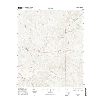
2014 Map of Glen Alta
USGS Topo · Published 2014About this map
Ochillee Cr and its various tributaries, including Hollis Br and Dry Cr, carve a complex drainage pattern across the border of Chattahoochee and Marion counties. This 2014 survey captures a landscape defined by small named settlements and agricultural outposts like Glen Alta, Ida Vesper, and Christopher. The road network is a mix of state routes and specifically named local tracks, such as Red Diamond Rd and Old Columbus Rd, which connect these rural communities. Notable elevation points like Bush Hill and Gobblers Hill rise above the creek valleys, while landmarks such as the Chattahoochee Lookout Tower provide orientation in the wooded terrain. The area is also dotted with private water features like Daniels Pond and Bagley Lake, indicating a history of managed land and local water usage.
Find a feature on this map
61 named features on this map. Tap any name to fly to it.
Don’t see what you’re looking for? This feature index may not catch every label — zoom into the map to look around manually.
Map Details
Editions of this 2014 Glen Alta Map
This is the sole edition of this map. No revisions or reprints were ever made.
Other maps of this area

1908 · Columbus
USGS Topo · 1:62,500

1929 · Columbus
USGS Topo · 1:48,000

1947 · Columbus
USGS Topo · 1:62,500

1949 · Glen Alta
USGS Topo · 1:24,000

1949 · Ochillee
USGS Topo · 1:24,000

1949 · Buena Vista NW
USGS Topo · 1:24,000

1949 · Cusseta
USGS Topo · 1:24,000

1950 · Louvale
USGS Topo · 1:24,000

1950 · Buena Vista NE
USGS Topo · 1:24,000

1950 · Buena Vista
USGS Topo · 1:24,000