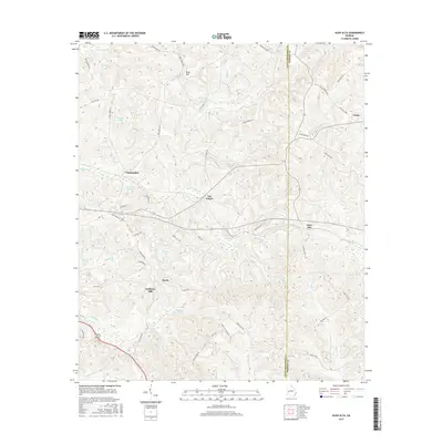
2017 Map of Glen Alta
USGS Topo · Published 2017About this map
Ochillee Cr and its various tributaries, including Hollis Cr and Bagley Cr, define the drainage patterns of this corner of the Georgia coastal plain. Small settlements such as Glen Alta, Christopher, and Manta are scattered among the ridges, often concentrated near local water sources like Anderson Lake or Bagley Lake. The topography is marked by distinct rises, notably Bush Hill in the north and Gobblers Hill toward the southwest, which dictate the winding paths of the local road network. Secondary routes like Hwy 137 and Fire Tower Rd connect these rural communities across the Chattahoochee Co and Marion Co boundary line. The map reflects a landscape of small ponds, such as Schley Pond and Daniels Pond, and a network of creeks that suggest a history of agricultural and timber land use in this part of Georgia.
Find a feature on this map
54 named features on this map. Tap any name to fly to it.
Don’t see what you’re looking for? This feature index may not catch every label — zoom into the map to look around manually.
Map Details
Editions of this 2017 Glen Alta Map
This is the sole edition of this map. No revisions or reprints were ever made.
Other maps of this area

1908 · Columbus
USGS Topo · 1:62,500

1929 · Columbus
USGS Topo · 1:48,000

1947 · Columbus
USGS Topo · 1:62,500

1949 · Glen Alta
USGS Topo · 1:24,000

1949 · Ochillee
USGS Topo · 1:24,000

1949 · Buena Vista NW
USGS Topo · 1:24,000

1949 · Cusseta
USGS Topo · 1:24,000

1950 · Louvale
USGS Topo · 1:24,000

1950 · Buena Vista NE
USGS Topo · 1:24,000

1950 · Buena Vista
USGS Topo · 1:24,000