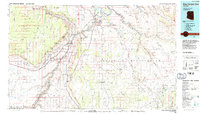
1984 Map of Glen Canyon Dam
USGS Topo · Published 1984About this map
Glen Canyon Dam serves as the focal point for this mid-1980s landscape, holding back the waters of Lake Powell where the Colorado River enters the narrow corridor of Marble Canyon. The map reveals a region defined by industrial energy and cultural boundaries, anchored by the city of Page and the massive Navajo Generating Station. To the south and east, the vast Navajo Indian Reservation covers the Kaibito Plateau, dotted with local landmarks like the Copper Mine Trading Post and the Lechee-e Chapter house.
Find a feature on this map
146 named features on this map. Tap any name to fly to it.
Don’t see what you’re looking for? This feature index may not catch every label — zoom into the map to look around manually.
Map Details
Editions of this 1984 Glen Canyon Dam Map
2 editions found
Other maps of this area

1883 · Marsh Pass
USGS Topo · 1:250,000

1886 · Kanab
USGS Topo · 1:250,000

1886 · Escalante
USGS Topo · 1:250,000

1886 · Henry Mountains
USGS Topo · 1:250,000

1886 · Echo Cliffs
USGS Topo · 1:250,000

1886 · Kaibab
USGS Topo · 1:250,000

1891 · Echo Cliffs
USGS Topo · 1:250,000

1892 · Marsh Pass
USGS Topo · 1:250,000

1892 · Henry Mountains
USGS Topo · 1:250,000

1922 · Warm Creek
USGS Topo · 1:63,360