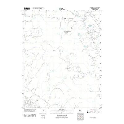
2012 Map of Glen Ellen
USGS Topo · Published 2012About this map
The Sonoma Mountain landscape defines this region of Sonoma County, where agricultural traditions and residential enclaves meet. In the northern reaches, the Jack London Ranch and Wellington Vineyards occupy the drainages of Stuart Creek and Graham Creek, signaling the area's deep-rooted viticulture near Glen Ellen. Further south, the map details the community of Eldridge and its landmark Eldridge Cemetery, while Sonoma Vista anchors the southeastern slopes. The topography is defined by the Sonoma Mountains ridgeline, which separates the Sonoma Creek watershed from the western valleys. To the southwest, the Petaluma Municipal Airport and Petaluma Reservoir represent key infrastructure serving the neighboring city. This 2012 survey illustrates a transition from the dense winery lands like Valley of the Moon Winery to the open spaces of Pine Tree Meadows and Stony Butte.
Find a feature on this map
104 named features on this map. Tap any name to fly to it.
Don’t see what you’re looking for? This feature index may not catch every label — zoom into the map to look around manually.
Map Details
Editions of this 2012 Glen Ellen Map
This is the sole edition of this map. No revisions or reprints were ever made.
Other maps of this area

1902 · Napa
USGS Topo · 1:125,000

1914 · Petaluma
USGS Topo · 1:62,500

1916 · Mare Island
USGS Topo · 1:62,500

1916 · Santa Rosa
USGS Topo · 1:62,500

1942 · Mare Island
USGS Topo · 1:62,500

1942 · Sonoma
USGS Topo · 1:62,500

1942 · Petaluma
USGS Topo · 1:62,500

1944 · Santa Rosa
USGS Topo · 1:62,500

1947 · Santa Rosa
USGS Topo · 1:250,000

1949 · Santa Rosa
USGS Topo · 1:250,000