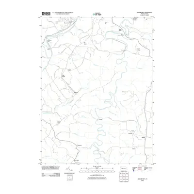
2010 Map of Glen Richey
USGS Topo · Published 2010About this map
Clearfield Creek winds through the heart of this landscape, carving a deep valley that connects a string of rural Pennsylvania settlements including Faunce, Sanborn, and Dimeling. This 2010 survey highlights a region shaped by industry and transport, where the West Branch Susquehanna River passes through a tight river bend known as The Narrows. Historical land use is evident in the numerous burial grounds documented, from the large Crown Crest Memorial Park near Hyde to smaller family and community sites like Stoneville Cemetery and Baughman Cemetery.
Find a feature on this map
82 named features on this map. Tap any name to fly to it.
Don’t see what you’re looking for? This feature index may not catch every label — zoom into the map to look around manually.
Map Details
Editions of this 2010 Glen Richey Map
This is the sole edition of this map. No revisions or reprints were ever made.
Other maps of this area

1903 · Curwensville
USGS Topo · 1:62,500

1903 · Houtzdale
USGS Topo · 1:62,500

1905 · Houtzdale
USGS Topo · 1:62,500

1929 · Clearfield
USGS Topo · 1:48,000

1929 · Penfield
USGS Topo · 1:62,500

1932 · Clearfield
USGS Topo · 1:62,500

1932 · Penfield
USGS Topo · 1:62,500

1939 · Curwensville
USGS Topo · 1:62,500

1942 · Curwensville
USGS Topo · 1:62,500

1943 · Punxsutawney
USGS Topo · 1:125,000
Featured Places
- Knox Township, PA
- Woodward Township, PA
- Lawrence Township, PA
- Mount Hope, Lawrence Township
- Oshanter, Lawrence Township