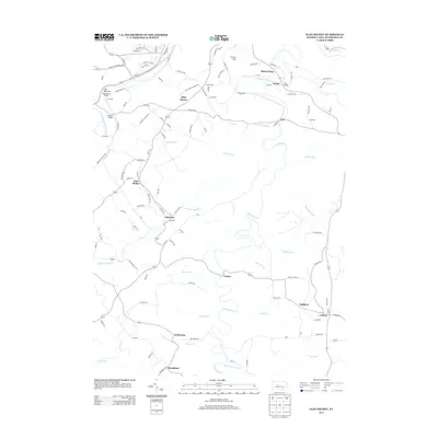
2013 Map of Glen Richey
USGS Topo · Published 2013About this map
Clearfield Creek carves a winding path through the center of this landscape, its tight oxbows defining the topography between the scattered settlements of Knox Township. The map captures the region's industrial and rural character, with Carbon Mine Rd and Coal Rd hinting at the subsurface resources that shaped these communities. To the north, The Narrows and Clover Hill rise above the confluence of smaller tributaries, while numerous bridges such as Porters Bridge and Litz Bridge connect the early thoroughfares. Small, distinct hamlets like Oshanter, Mitchells, and Glen Richey are distributed along the ridge-top roads, reflecting a settlement pattern tied to the rugged terrain and coal-mining history of the Pennsylvania heartland. Farther south, the road network links Kellytown and Boardman near the headwaters of Little Potts Run, showing the enduring footprint of these central Pennsylvania villages.
Find a feature on this map
117 named features on this map. Tap any name to fly to it.
Don’t see what you’re looking for? This feature index may not catch every label — zoom into the map to look around manually.
Map Details
Editions of this 2013 Glen Richey Map
This is the sole edition of this map. No revisions or reprints were ever made.
Other maps of this area

1903 · Curwensville
USGS Topo · 1:62,500

1903 · Houtzdale
USGS Topo · 1:62,500

1905 · Houtzdale
USGS Topo · 1:62,500

1929 · Clearfield
USGS Topo · 1:48,000

1929 · Penfield
USGS Topo · 1:62,500

1932 · Clearfield
USGS Topo · 1:62,500

1932 · Penfield
USGS Topo · 1:62,500

1939 · Curwensville
USGS Topo · 1:62,500

1942 · Curwensville
USGS Topo · 1:62,500

1943 · Punxsutawney
USGS Topo · 1:125,000
Featured Places
- Knox Township, PA
- Woodward Township, PA
- Lawrence Township, PA
- Mount Hope, Lawrence Township
- Oshanter, Lawrence Township