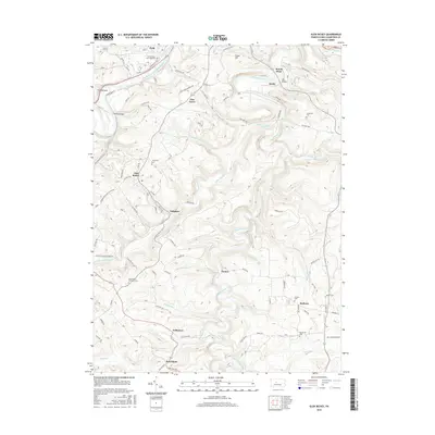
2016 Map of Glen Richey
USGS Topo · Published 2016About this map
The West Branch Susquehanna River winds through the northern reaches of this Pennsylvania landscape, while Clearfield Creek carves a deep, serpentine path through the central and southern terrain. This 2016 survey documents a region defined by its small upland settlements and the remnants of industrial infrastructure, such as Litz Bridge near Krebs. Small communities like Glen Richey, Oshanter, and Boardman are connected by a network of rural roads that follow the ridges and valleys of the Allegheny Plateau. Genealogists will find a high density of burial sites throughout the area, including Crown Crest Memorial Park, Stoneville Cem, and Mount Zion Memorial Cem. The map illustrates the characteristic settlement pattern of Clearfield County, where towns often developed in close proximity to coal and timber resources along waterways like Little Clearfield Cr and Potts Run.
Find a feature on this map
116 named features on this map. Tap any name to fly to it.
Don’t see what you’re looking for? This feature index may not catch every label — zoom into the map to look around manually.
Map Details
Editions of this 2016 Glen Richey Map
This is the sole edition of this map. No revisions or reprints were ever made.
Other maps of this area

1903 · Curwensville
USGS Topo · 1:62,500

1903 · Houtzdale
USGS Topo · 1:62,500

1905 · Houtzdale
USGS Topo · 1:62,500

1929 · Clearfield
USGS Topo · 1:48,000

1929 · Penfield
USGS Topo · 1:62,500

1932 · Clearfield
USGS Topo · 1:62,500

1932 · Penfield
USGS Topo · 1:62,500

1939 · Curwensville
USGS Topo · 1:62,500

1942 · Curwensville
USGS Topo · 1:62,500

1943 · Punxsutawney
USGS Topo · 1:125,000
Featured Places
- Knox Township, PA
- Woodward Township, PA
- Lawrence Township, PA
- Mount Hope, Lawrence Township
- Oshanter, Lawrence Township