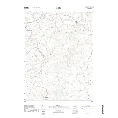
2019 Map of Glen Richey
USGS Topo · Published 2019About this map
Clearfield Creek and its many tributaries, including Little Clearfield Cr and Wallace Run, carve a complex network of valleys through this part of the Appalachian Plateaus. In this modern survey, the landscape is defined by its rural heritage and industrial history, evidenced by the presence of numerous small settlements such as Glen Richey, Oshanter, and Faunce. The northern reach is bounded by the West Branch Susquehanna River, which flows near Curwensville. Genealogy researchers will find substantial value in the high density of documented burial sites, ranging from the large Crown Crest Memorial Park to smaller, local plots like Pine Grove Bethel Cem, Thompson Cem, and Baughman Cem. The local road network, including the Old Erie Pike, connects these communities and landmarks across terrain marked by named heights like Whiskey Hill and Turkey Hill. The map also illustrates the legacy of land use in the region, with labels such as Stripping Rd hinting at the area's coal mining history.
Find a feature on this map
71 named features on this map. Tap any name to fly to it.
Don’t see what you’re looking for? This feature index may not catch every label — zoom into the map to look around manually.
Map Details
Editions of this 2019 Glen Richey Map
This is the sole edition of this map. No revisions or reprints were ever made.
Other maps of this area

1903 · Curwensville
USGS Topo · 1:62,500

1903 · Houtzdale
USGS Topo · 1:62,500

1905 · Houtzdale
USGS Topo · 1:62,500

1929 · Clearfield
USGS Topo · 1:48,000

1929 · Penfield
USGS Topo · 1:62,500

1932 · Clearfield
USGS Topo · 1:62,500

1932 · Penfield
USGS Topo · 1:62,500

1939 · Curwensville
USGS Topo · 1:62,500

1942 · Curwensville
USGS Topo · 1:62,500

1943 · Punxsutawney
USGS Topo · 1:125,000
Featured Places
- Knox Township, PA
- Woodward Township, PA
- Lawrence Township, PA
- Mount Hope, Lawrence Township
- Oshanter, Lawrence Township