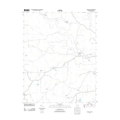
2011 Map of Glenallen
USGS Topo · Published 2011About this map
Glenallen and the surrounding rural landscape of Bollinger County are defined by a complex network of waterways, including Crooked Creek and Little Crooked Creek. The topography is marked by several narrow valleys or hollows, such as Black Snake Hollow to the north and Robey Hollow in the southeast. This 2011 survey reveals a settlement pattern of small communities like Bessville, Grassy, and Huxie, connected by an extensive system of numbered county roads. Family history and local heritage are preserved through numerous burial grounds, including the Mouser Cemetery, Myers Cemetery, and Shelton Cemetery. The geography also includes significant water management features such as the Number 632 Dam and Wright Lake Dam, which create small reservoirs like Reed Lake and Marquis Lake amidst the undulating terrain.
Find a feature on this map
51 named features on this map. Tap any name to fly to it.
Don’t see what you’re looking for? This feature index may not catch every label — zoom into the map to look around manually.
Map Details
Editions of this 2011 Glenallen Map
This is the sole edition of this map. No revisions or reprints were ever made.
Other maps of this area

1933 · Marble Hill
USGS Topo · 1:62,500

1933 · Marquand
USGS Topo · 1:62,500

1934 · Advance
USGS Topo · 1:62,500

1935 · Zalma
USGS Topo · 1:62,500

1937 · Marble Hill
USGS Topo · 1:62,500

1938 · Marquand
USGS Topo · 1:62,500

1939 · Advance
USGS Topo · 1:62,500

1939 · Zalma
USGS Topo · 1:62,500

1949 · Paducah
USGS Topo · 1:250,000

1949 · Rolla
USGS Topo · 1:250,000