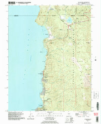
1992 Map of Glenbrook
USGS Topo · Published 1994About this map
Lake Tahoe dominates the western half of this quadrangle, its shoreline revealing the mid-twentieth-century residential and recreational development of the Nevada side. The settlement of Glenbrook serves as a primary focal point, showing the established grid and piers along the bay. This 1992 revision, based on earlier imagery, provides a detailed look at the interface between the lake's edge and the rising topography of the Carson Range. The map effectively captures the density of lakeside infrastructure before the turn of the century, documenting the footprint of local communities and the preservation of the surrounding mountain landscape.
Find a feature on this map
2 named features on this map. Tap any name to fly to it.
Don’t see what you’re looking for? This feature index may not catch every label — zoom into the map to look around manually.
Map Details
Editions of this 1992 Glenbrook Map
2 editions found
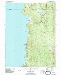
Other maps of this area

1889 · Pyramid Peak
USGS Topo · 1:125,000

1889 · Markleeville
USGS Topo · 1:125,000

1891 · Carson
USGS Topo · 1:125,000

1891 · Markleeville
USGS Topo · 1:125,000

1891 · Truckee
USGS Topo · 1:125,000

1891 · Pyramid Peak
USGS Topo · 1:125,000

1893 · Carson
USGS Topo · 1:125,000

1893 · Markleeville
USGS Topo · 1:125,000

1893 · Truckee
USGS Topo · 1:125,000

1895 · Pyramid Peak
USGS Topo · 1:125,000