
1949 Map of Glenburn
USGS Topo · Published 1949About this map
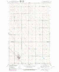
Glenburn serves as the focal point for this late 1940s landscape, situated along the Great Northern railroad line. The settlement pattern is defined by a traditional rural grid, where the boundaries of Ensign, Prescott, Chatfield, and Elms meet. This survey provides a precise record of the Missouri River Basin development program's focus on these plains, showing the distribution of essential community landmarks like School No 1, School No 2, and School No 4.
Find a feature on this map
13 named features on this map. Tap any name to fly to it.
Don’t see what you’re looking for? This feature index may not catch every label — zoom into the map to look around manually.
Map Details
Editions of this 1949 Glenburn Map
2 editions found
Other maps of this area

1948 · Lansford
USGS Topo · 1:62,500

1948 · Burlington
USGS Topo · 1:62,500

1949 · Deering NW
USGS Topo · 1:24,000

1949 · Lansford SE
USGS Topo · 1:24,000

1949 · Lansford NE
USGS Topo · 1:24,000

1949 · Maxbass
USGS Topo · 1:24,000

1949 · Eckman SE
USGS Topo · 1:24,000

1949 · Eckman
USGS Topo · 1:24,000

1949 · Deering
USGS Topo · 1:24,000
1949 · Burlington NE
USGS Topo · 1:24,000