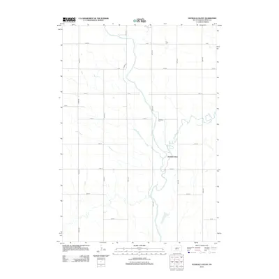
2012 Map of Glendale Colony
USGS Topo · Published 2012About this map
The James River dictates the landscape of this Spink County territory, winding southward through a network of section-line roads and prairie acreage. Glendale Colony sits at the heart of this agricultural region, established near the river banks where Timber Cr joins the main flow from the east. The map records essential local landmarks for family history researchers, including Trinity Cem in the northern reaches and Guttenberg Cem situated near the river's bend. A strictly organized grid of thoroughfares like Co Hwy-11 and 174th St provides access to the surrounding farmsteads, illustrating the enduring township-and-range settlement pattern that has defined South Dakota's rural character since the late 19th century.
Find a feature on this map
24 named features on this map. Tap any name to fly to it.
Don’t see what you’re looking for? This feature index may not catch every label — zoom into the map to look around manually.
Map Details
Editions of this 2012 Glendale Colony Map
This is the sole edition of this map. No revisions or reprints were ever made.
Other maps of this area

1895 · Byron
USGS Topo · 1:125,000

1953 · Frankfort
USGS Topo · 1:24,000

1953 · Ashton
USGS Topo · 1:24,000

1953 · Huron
USGS Topo · 1:250,000

1954 · Huron
USGS Topo · 1:250,000

1956 · Lake Byron NW
USGS Topo · 1:24,000

1956 · Glendale Colony
USGS Topo · 1:24,000

1956 · Spink Colony
USGS Topo · 1:24,000

1956 · Doland SW
USGS Topo · 1:24,000

1967 · Frankfort SW
USGS Topo · 1:24,000