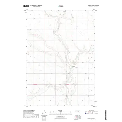
2017 Map of Glendale Colony
USGS Topo · Published 2017About this map
The James River snakes through the heart of Spink County, carving a distinct valley through the agricultural landscape of Frankfort Township. This 2017 survey shows the enduring presence of the Glendale Colony, an intentional community situated along the river's eastern banks. The settlement pattern is defined by a grid of rural routes including 395th Ave and Co Rd 22, which connect the scattered homesteads and communal sites. Evidence of the area's social history is preserved in several burial grounds, including the Trinity Cem in the north and the Guttenberg Cem located on a bluff overlooking a bend in the river. Near the confluence where Timber Creek joins the main waterway, the Glendale Colony Cem serves as a final resting place for the local community. The terrain remains largely dedicated to large-scale farming, with sections demarcated by early township boundaries.
Find a feature on this map
22 named features on this map. Tap any name to fly to it.
Don’t see what you’re looking for? This feature index may not catch every label — zoom into the map to look around manually.
Map Details
Editions of this 2017 Glendale Colony Map
This is the sole edition of this map. No revisions or reprints were ever made.
Other maps of this area

1895 · Byron
USGS Topo · 1:125,000

1953 · Frankfort
USGS Topo · 1:24,000

1953 · Ashton
USGS Topo · 1:24,000

1953 · Huron
USGS Topo · 1:250,000

1954 · Huron
USGS Topo · 1:250,000

1956 · Lake Byron NW
USGS Topo · 1:24,000

1956 · Glendale Colony
USGS Topo · 1:24,000

1956 · Spink Colony
USGS Topo · 1:24,000

1956 · Doland SW
USGS Topo · 1:24,000

1967 · Frankfort SW
USGS Topo · 1:24,000