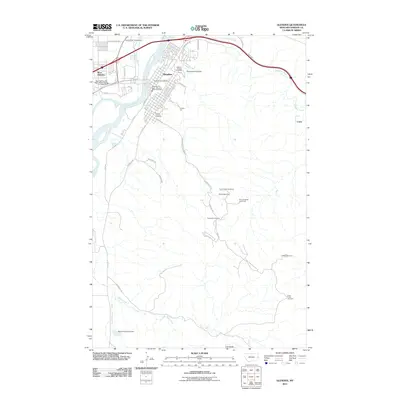
2011 Map of Glendive
USGS Topo · Published 2011About this map
The Yellowstone River anchors this landscape, dividing Glendive from its western counterpart as the waterway flows past the residential blocks and civic center. The map reveals a community defined by its proximity to the water and the rugged breaks of the badlands to the south, where the Makoshika State Park Rd leads into a terrain of deeply incised drainages. To the north, the town’s footprint is bounded by the modern infrastructure of the interstate corridor, while the Dawson County Cemetery and Graveyard Coulee mark the transition from the city grid to the open plains.
Find a feature on this map
47 named features on this map. Tap any name to fly to it.
Don’t see what you’re looking for? This feature index may not catch every label — zoom into the map to look around manually.
Map Details
Editions of this 2011 Glendive Map
This is the sole edition of this map. No revisions or reprints were ever made.
Other maps of this area

1909 · Glendive
USGS Topo · 1:250,000

1953 · Miles City
USGS Topo · 1:250,000

1954 · Glendive
USGS Topo · 1:250,000

1957 · Miles City
USGS Topo · 1:250,000

1957 · Glendive
USGS Topo · 1:250,000

1958 · Miles City
USGS Topo · 1:250,000

1958 · Glendive
USGS Topo · 1:250,000

1967 · Stipek
USGS Topo · 1:24,000

1967 · Allard
USGS Topo · 1:24,000

1967 · Belle Prairie
USGS Topo · 1:24,000
Featured Places
- Glendive, MT
- Casitas Del Rio, Glendive
- Highland Mobile Home Park, MT
- Spring Grove Trailer Court, MT
- West Glendive, MT