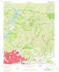
1966 Map of Glendora
USGS Topo · Published 1968About this map
The northern foothills of the San Gabriel Mountains meet the expanding residential tracts of the San Gabriel Valley in this mid-1960s survey. The city of Glendora is the primary settlement, showing a dense grid of schools including Harding Academy and Goddard Jr High Sch, all serviced by the Atchison Topeka and Santa Fe railroad. To the north, the landscape shifts abruptly into the Angeles National Forest, where steep canyons are managed for water and research. The massive San Gabriel Reservoir and Morris Reservoir dominate the upper reaches, with the latter notably featuring the US Naval Ordnance Testing Station. This area also includes the specialized terrain of the San Dimas Experimental Forest, containing landmarks like the Johnstone Peak lookout tower. Recreational sites and remote outposts like Follows Camp and Camp Oak Grove reflect the region's importance for both watershed protection and mountain access.
Find a feature on this map
61 named features on this map. Tap any name to fly to it.
Don’t see what you’re looking for? This feature index may not catch every label — zoom into the map to look around manually.
Map Details
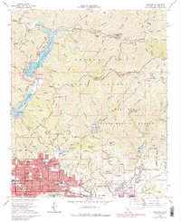
Editions of this 1966 Glendora Map
2 editions found
Other maps of this area

1894 · Pomona
USGS Topo · 1:62,500

1897 · Pomona
USGS Topo · 1:62,500

1897 · Cucamonga
USGS Topo · 1:62,500

1898 · Pomona
USGS Topo · 1:62,500

1900 · Cucamonga
USGS Topo · 1:62,500

1901 · Southern California Sheet No. 1
USGS Topo · 1:250,000

1903 · Rock Creek
USGS Topo · 1:62,500

1903 · Cucamonga
USGS Topo · 1:62,500

1903 · San Antonio
USGS Topo · 1:62,500

1904 · Pomona
USGS Topo · 1:62,500