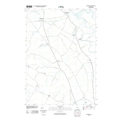
2010 Map of Glenfield
USGS Topo · Published 2010About this map
Martinsburg and the riverside hamlet of Glenfield anchor this Lewis County landscape where the Tug Hill plateau begins its descent toward the Black River valley. The geography is defined by significant elevation changes, most notably at Whetstone Gulf State Park, where Whetstone Creek has carved a deep gorge through the shale. Smaller settlements like Houseville, Glendale, and Turin are connected by a network of rural roads such as Houseville Rd and East Rd. Genealogists will find several burial grounds documented, including the Old Martinsburg Cemetery and the Collinsville Cemetery near the southern boundary. The drainage pattern is complex, with Independence River and Roaring Brook feeding the larger river system, reflecting the area's transition from high wooded gulfs to fertile river bottomlands.
Find a feature on this map
63 named features on this map. Tap any name to fly to it.
Don’t see what you’re looking for? This feature index may not catch every label — zoom into the map to look around manually.
Map Details
Editions of this 2010 Glenfield Map
This is the sole edition of this map. No revisions or reprints were ever made.
Other maps of this area

1902 · Carthage
USGS Topo · 1:62,500

1904 · Carthage
USGS Topo · 1:62,500

1905 · Port Leyden
USGS Topo · 1:62,500

1906 · Highmarket
USGS Topo · 1:62,500

1907 · Port Leyden
USGS Topo · 1:62,500

1911 · Lowville
USGS Topo · 1:62,500

1913 · Lowville
USGS Topo · 1:62,500

1940 · Port Leyden
USGS Topo · 1:62,500

1943 · West Lowville
USGS Topo · 1:31,680

1943 · High Market
USGS Topo · 1:24,000