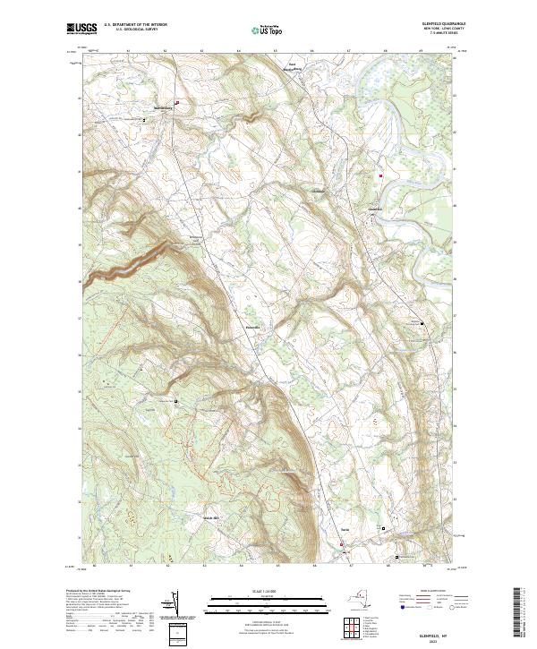
2023 Map of Glenfield
USGS Topo · Published 2023About this map
Black River meanders through the eastern lowlands of Lewis County, contrasting with the dramatic elevation changes of the Tug Hill plateau to the west. This landscape is defined by the deep incision of Whetstone Gulf, a notable gorge protected within Whetstone Gulf State Park. The transition from the alluvial valley floor to the upland heights is marked by numerous water features, including the cascading Whitaker Falls and the drainage of Roaring Brook. The settlement pattern follows the fertile corridor along the river and the base of the plateau, with long-established communities like Martinsburg, Turin, and Glenfield serving as local anchors. For genealogists, the map preserves the locations of several community burial grounds, such as Martinsburg Cem and Collinsville Cem, while numerous rural roads like Whiskey Lane Rd and Houseville Gulf Rd hint at the historic agricultural and timber-linked routes of the region.
Find a feature on this map
84 named features on this map. Tap any name to fly to it.
Don’t see what you’re looking for? This feature index may not catch every label — zoom into the map to look around manually.
Map Details
Editions of this 2023 Glenfield Map
This is the sole edition of this map. No revisions or reprints were ever made.
Other maps of this area

1902 · Carthage
USGS Topo · 1:62,500

1904 · Carthage
USGS Topo · 1:62,500

1905 · Port Leyden
USGS Topo · 1:62,500

1906 · Highmarket
USGS Topo · 1:62,500

1907 · Port Leyden
USGS Topo · 1:62,500

1911 · Lowville
USGS Topo · 1:62,500

1913 · Lowville
USGS Topo · 1:62,500

1940 · Port Leyden
USGS Topo · 1:62,500

1943 · West Lowville
USGS Topo · 1:31,680

1943 · High Market
USGS Topo · 1:24,000