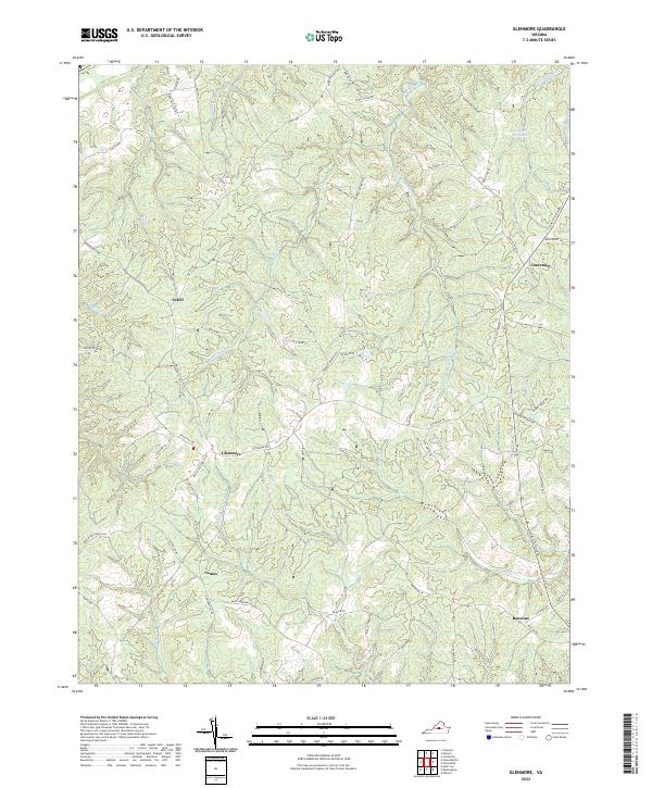
2022 Map of Glenmore
USGS Topo · Published 2022About this map
Centenary and Glenmore anchor this section of central Virginia, where a dense network of local roads and watercourses defines the landscape. The geography is characterized by the branching drainages of Rock Island Cr and Little Rock Island Cr, which feed into the James River system just north of this sheet. Settlement patterns follow the ridgelines between these creeks, with small community centers like Axtell and Camm connected by historic routes such as Howardsville Rd and State Rte 740.
Find a feature on this map
65 named features on this map. Tap any name to fly to it.
Don’t see what you’re looking for? This feature index may not catch every label — zoom into the map to look around manually.
Map Details
Editions of this 2022 Glenmore Map
This is the sole edition of this map. No revisions or reprints were ever made.
Other maps of this area

1891 · Palmyra
USGS Topo · 1:125,000

1892 · Buckingham
USGS Topo · 1:125,000

1895 · Palmyra
USGS Topo · 1:125,000

1897 · Palmyra
USGS Topo · 1:125,000

1929 · Covesville
USGS Topo · 1:62,500

1935 · Covesville
USGS Topo · 1:62,500

1943 · Scottsville
USGS Topo · 1:62,500

1945 · Covesville
USGS Topo · 1:62,500

1946 · Scottsville
USGS Topo · 1:62,500

1947 · Roanoke
USGS Topo · 1:250,000