1964 Map of Glenn
USGS Topo · Published 1991About this map
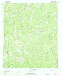
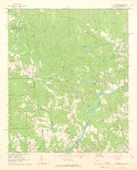
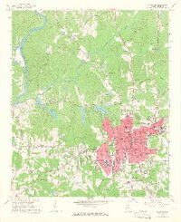
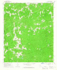
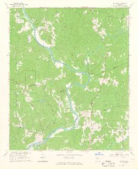
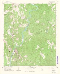
Alabama Georgia state line markers define the western edge of this rural landscape, which captures a network of small agricultural communities and family churches in the mid-1960s. The settlement of Glenn serves as a local hub near the southern border, while smaller crossroads such as Waresville, O'Neals Crossroads, and Texas anchor the northern reaches. The area is heavily defined by its watercourses, notably Whitewater Creek and Little Wehadkee Creek, which carved the winding valleys that shaped local road placement.
Find a feature on this map
30 named features on this map. Tap any name to fly to it.
Don’t see what you’re looking for? This feature index may not catch every label — zoom into the map to look around manually.
Map Details
Editions of this 1964 Glenn Map
2 editions found
Other maps of this area

1899 · Wedowee
USGS Topo · 1:125,000

1902 · Wedowee
USGS Topo · 1:125,000

1953 · Atlanta
USGS Topo · 1:250,000

1957 · Atlanta
USGS Topo · 1:250,000

1958 · Atlanta
USGS Topo · 1:250,000
1964 · Abbottsford
USGS Topo · 1:24,000
1964 · La Grange
USGS Topo · 1:24,000
1964 · Glenn
USGS Topo · 1:24,000
1964 · Hillcrest
USGS Topo · 1:24,000
1964 · Franklin
USGS Topo · 1:24,000