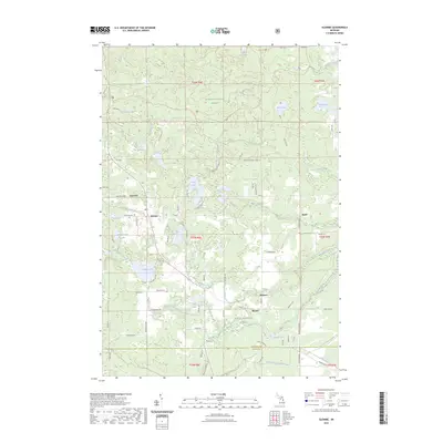
2023 Map of Glennie
USGS Topo · Published 2023About this map
Glennie serves as the primary hub of this northern Michigan landscape, situated where Bamfield Rd meets the local street grid. The settlement is anchored by the Glennie Cem and is surrounded by the vast timberlands of the Huron National Forest. The geography is defined by a dense network of glacial kettle lakes and small waterways, including Vaughn Lake, Thompson Lake, and the Indian Lakes.
Find a feature on this map
51 named features on this map. Tap any name to fly to it.
Don’t see what you’re looking for? This feature index may not catch every label — zoom into the map to look around manually.
Map Details
Editions of this 2023 Glennie Map
This is the sole edition of this map. No revisions or reprints were ever made.
Other maps of this area

1954 · Tawas City
USGS Topo · 1:250,000

1958 · Tawas City
USGS Topo · 1:250,000

1959 · Tawas City
USGS Topo · 1:62,500

1959 · Glennie
USGS Topo · 1:62,500

1968 · Hale
USGS Topo · 1:24,000

1972 · Curran
USGS Topo · 1:24,000

1972 · Alcona Dam Pond
USGS Topo · 1:24,000

1983 · Hubbard Lake
USGS Topo · 1:100,000

1984 · Tawas City
USGS Topo · 1:100,000
1989 · Barton City
USGS Topo · 1:24,000