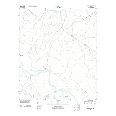
2011 Map of Glennville SW
USGS Topo · Published 2011About this map
The Altamaha River carves a winding course through this section of Long County, defining a landscape of wetlands and low-lying river bends such as Marrowbone Round and Strickland Bight. Just north of the river, the settlement of Beards Bluff overlooks the water, while the interior is marked by a network of rural roads connecting scattered sites like the small community of Noble and the historic Padgett Cemetery.
Find a feature on this map
46 named features on this map. Tap any name to fly to it.
Don’t see what you’re looking for? This feature index may not catch every label — zoom into the map to look around manually.
Map Details
Editions of this 2011 Glennville SW Map
This is the sole edition of this map. No revisions or reprints were ever made.
Other maps of this area

1918 · Jesup
USGS Topo · 1:62,500

1920 · Glennville
USGS Topo · 1:62,500

1943 · Jesup
USGS Topo · 1:62,500

1944 · Glennville
USGS Topo · 1:62,500

1946 · Brunswick
USGS Topo · 1:250,000

1948 · Brunswick
USGS Topo · 1:250,000

1950 · Glennville
USGS Topo · 1:62,500

1953 · Waycross
USGS Topo · 1:250,000

1956 · Brunswick
USGS Topo · 1:250,000

1958 · Waycross
USGS Topo · 1:250,000