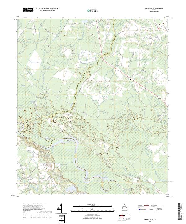
2024 Map of Glennville SW
USGS Topo · Published 2024About this map
The Altamaha River winds through the borderlands of Tattnall, Long, and Wayne Counties, defining a landscape of cypress swamps and riverine islands. This 2024 map documents the historic river crossing at Beards Bluff, where the Beards Bluff Ferry once linked the northern banks to the southern reaches near Strickland Bight. The interior terrain is a complex network of wetlands and namesake basins, including Mushmelon Creek, Watermelon Creek, and the expansive Black Swamp. For genealogists, the map preserves the location of rural burial grounds like Padgett Cem and Pigot Branch Cem, alongside the Ebenezer Free Will Cem in the northeast corner. These sites, often located at the terminus of local roads like Ed Cadanner Rd NE, serve as primary markers of early settlement patterns in this corner of the Georgia coastal plain.
Find a feature on this map
66 named features on this map. Tap any name to fly to it.
Don’t see what you’re looking for? This feature index may not catch every label — zoom into the map to look around manually.
Map Details
Editions of this 2024 Glennville SW Map
This is the sole edition of this map. No revisions or reprints were ever made.
Other maps of this area

1918 · Jesup
USGS Topo · 1:62,500

1920 · Glennville
USGS Topo · 1:62,500

1943 · Jesup
USGS Topo · 1:62,500

1944 · Glennville
USGS Topo · 1:62,500

1946 · Brunswick
USGS Topo · 1:250,000

1948 · Brunswick
USGS Topo · 1:250,000

1950 · Glennville
USGS Topo · 1:62,500

1953 · Waycross
USGS Topo · 1:250,000

1956 · Brunswick
USGS Topo · 1:250,000

1958 · Waycross
USGS Topo · 1:250,000