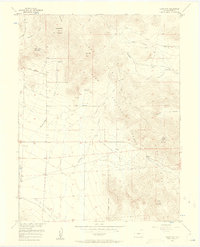
1956 Map of Glentivar
USGS Topo · Published 1960About this map
Puma Hills dominate this high-altitude landscape of Park County, where the 1956 terrain is defined by complex drainage systems and several significant peaks. The small settlement of Glentivar serves as a lone hub in an area otherwise characterized by rugged peaks like Schoolmarm Mountain and Badger Mountain. This survey was conducted for the development of the Missouri River Basin and captures a network of resource-oriented infrastructure, including the prominent Aqueduct and La Salle Road. High-country passes such as Wilkerson Pass and La Salle Pass provide the primary routes through the mountains, while numerous family-named features like Rishaberger Mountain and Marksbury Gulch reflect the era's local geography. Water sources like Rishaberger Spring and Allen Creek provide a look at the hydrologic layout of the Pike National Forest interior before mid-century expansion.
Find a feature on this map
28 named features on this map. Tap any name to fly to it.
Don’t see what you’re looking for? This feature index may not catch every label — zoom into the map to look around manually.
Map Details
Editions of this 1956 Glentivar Map
5 editions found

Other maps of this area

1893 · Platte Canyon
USGS Topo · 1:125,000

1894 · Pikes Peak
USGS Topo · 1:125,000

1901 · Pikes Peak
USGS Topo · 1:125,000

1953 · Denver
USGS Topo · 1:250,000

1954 · Pueblo
USGS Topo · 1:250,000

1956 · Eagle Rock
USGS Topo · 1:24,000

1956 · Mc Curdy Mountain
USGS Topo · 1:24,000

1956 · Tarryall
USGS Topo · 1:24,000

1956 · Sulphur Mountain
USGS Topo · 1:24,000

1956 · Elevenmile Canyon
USGS Topo · 1:24,000