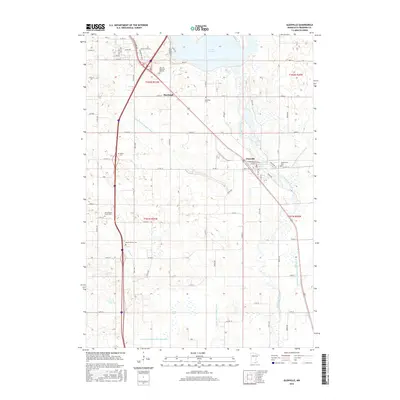
2016 Map of Glenville
USGS Topo · Published 2016About this map
Glenville serves as the central hub of this agricultural landscape in southern Minnesota, situated where the Shell Rock River flows south from Albert Lea Lake. The map reveals a high density of rural cemeteries and burial grounds, such as Greenwood Cem and Green Cem, which highlight the deep roots of the local farming community. The terrain is defined by an extensive drainage network, including County Ditch Number Sixteen and Judicial Ditch Number Twenty, illustrating the long-term engineering required to manage the wetlands and marshes common to this part of Freeborn County. Smaller settlements like Murtaugh and developed spaces like Hillcrest Memorial Gardens dot the corridors near the main rail and road routes. From the banks of Goose Cr to the quiet waters of Grass Lake, the sheet preserves the 21st-century configuration of a classic Midwestern township system.
Find a feature on this map
50 named features on this map. Tap any name to fly to it.
Don’t see what you’re looking for? This feature index may not catch every label — zoom into the map to look around manually.
Map Details
Editions of this 2016 Glenville Map
This is the sole edition of this map. No revisions or reprints were ever made.
Other maps of this area

1954 · Albert Lea
USGS Topo · 1:62,500

1954 · Hayward
USGS Topo · 1:62,500

1954 · Mason City
USGS Topo · 1:250,000

1957 · Mason City
USGS Topo · 1:250,000

1958 · Mason City
USGS Topo · 1:250,000

1972 · Northwood
USGS Topo · 1:24,000

1972 · Fertile NE
USGS Topo · 1:24,000

1972 · Bristol
USGS Topo · 1:24,000

1982 · Hayward
USGS Topo · 1:24,000

1982 · Albert Lea West
USGS Topo · 1:24,000
Featured Places
- Albert Lea, MN
- Glenville, MN
- Stoney Creek Estates, Albert Lea
- Rainbow Terrace Mobile Home Park, Albert Lea
- Murtaugh, MN