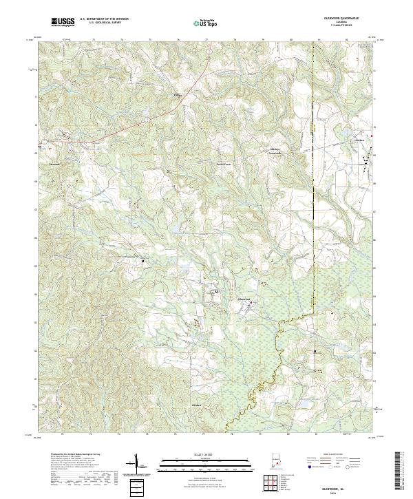
2024 Map of Glenwood
USGS Topo · Published 2024About this map
Conecuh River drainage patterns define this part of the Alabama coastal plain, where the landscape is marked by small agricultural hubs and family cemeteries. Small rural communities like Vidette, Social Town, and Shirleys Crossroads serve as navigational anchors across the county line dividing Crenshaw and Pike counties. The map highlights several points of interest for local historians, including Darien Church and numerous burial sites such as Emmaus Cem and the New Providence Cem. Topographically, the area transitions from the higher elevations of Goat Ridge in the southwest down toward the creek-fed lowlands of Sandy Creek and Buck Creek. The abundance of small bodies of water, including Folmer Ponds and Mandy-Warren Lake, suggests a landscape shaped by both natural drainage and private land management.
Find a feature on this map
102 named features on this map. Tap any name to fly to it.
Don’t see what you’re looking for? This feature index may not catch every label — zoom into the map to look around manually.
Map Details
Editions of this 2024 Glenwood Map
This is the sole edition of this map. No revisions or reprints were ever made.
Other maps of this area

1953 · Andalusia
USGS Topo · 1:250,000

1957 · Andalusia
USGS Topo · 1:250,000
1968 · Goshen
USGS Topo · 1:24,000
1968 · Youngblood
USGS Topo · 1:24,000
1968 · Bluff Springs
USGS Topo · 1:24,000

1968 · Glenwood
USGS Topo · 1:24,000

1968 · Bullock
USGS Topo · 1:24,000

1968 · Petrey
USGS Topo · 1:24,000

1971 · Luverne
USGS Topo · 1:24,000

1971 · Brantley
USGS Topo · 1:24,000