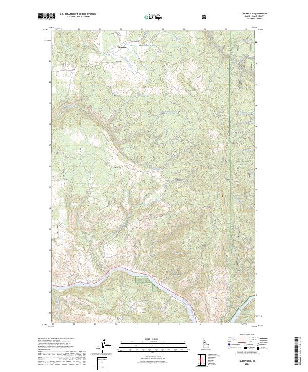
2024 Map of Glenwood
USGS Topo · Published 2024About this map
The settlement of Glenwood sits in the northern reaches of this Idaho landscape, where high-elevation ridges and deep creek drainages define the transition into federal forest lands. The southern portion of the map is dominated by the Middle Fork Clearwater River, a designated Middle Fork Clearwater Wild and Scenic River that serves as a primary geographic corridor. Between these points, the terrain rises sharply toward landmarks such as Maggie Butte and the elongated Harris Ridge, which is traversed by the winding Harris Ridge Rd.
Find a feature on this map
46 named features on this map. Tap any name to fly to it.
Don’t see what you’re looking for? This feature index may not catch every label — zoom into the map to look around manually.
Map Details
Editions of this 2024 Glenwood Map
This is the sole edition of this map. No revisions or reprints were ever made.
Other maps of this area

1924 · Weippe
USGS Topo · 1:125,000

1956 · Hamilton
USGS Topo · 1:250,000

1959 · Hamilton
USGS Topo · 1:250,000

1960 · Hamilton
USGS Topo · 1:250,000

1964 · Hamilton
USGS Topo · 1:250,000

1966 · Kooskia
USGS Topo · 1:24,000
1966 · Stites
USGS Topo · 1:24,000
1966 · Big Cedar
USGS Topo · 1:24,000
1966 · Glenwood
USGS Topo · 1:24,000
1966 · Brown Creek Ridge
USGS Topo · 1:24,000