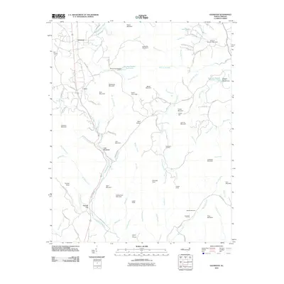
2010 Map of Glenwood
USGS Topo · Published 2010About this map
The Second Broad River and its numerous tributaries, including Rockhouse Creek and Scrub Grass Branch, define this pocket of McDowell County. The landscape is characterized by a series of named knobs and gaps, such as Indian Grave Gap and Camel Knob, which influenced the winding paths of local roads like Macedonia Church Loop and Polly Spout Rd. Water management is a visible priority across the terrain, evidenced by several engineered reservoirs including Structure Number Six B Lake and Structure Number Nineteen Lake.
Find a feature on this map
103 named features on this map. Tap any name to fly to it.
Don’t see what you’re looking for? This feature index may not catch every label — zoom into the map to look around manually.
Map Details
Editions of this 2010 Glenwood Map
This is the sole edition of this map. No revisions or reprints were ever made.
Other maps of this area

1900 · Mount Mitchell
USGS Topo · 1:125,000

1902 · Mount Mitchell
USGS Topo · 1:125,000

1905 · Morganton
USGS Topo · 1:125,000

1907 · Saluda
USGS Topo · 1:125,000

1953 · Charlotte
USGS Topo · 1:250,000

1954 · Charlotte
USGS Topo · 1:250,000

1955 · Knoxville
USGS Topo · 1:250,000

1957 · Knoxville
USGS Topo · 1:250,000

1959 · Lake Lure
USGS Topo · 1:62,500

1960 · Knoxville
USGS Topo · 1:250,000