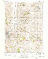
1956 Map of Glenwood
USGS Topo · Published 1976About this map
Glenwood serves as the focal point of this southwestern Iowa landscape in the mid-1950s, characterized by its dense network of rural one-room schools and diverging rail lines. The town’s southern edge is marked by the expansive State School grounds and the recreational area of Glenwood Lake Park. To the northeast, the Wabash railroad cuts across the corner of the map through Silver City, while the Chicago Burlington and Quincy line carries traffic through the center toward Balfour.
Find a feature on this map
30 named features on this map. Tap any name to fly to it.
Don’t see what you’re looking for? This feature index may not catch every label — zoom into the map to look around manually.
Map Details
Editions of this 1956 Glenwood Map
3 editions found
Other maps of this area

1935 · Nehawka
USGS Topo · 1:48,000

1940 · Nehawka
USGS Topo · 1:62,500

1954 · Omaha
USGS Topo · 1:250,000

1955 · Nebraska City
USGS Topo · 1:250,000

1956 · Glenwood
USGS Topo · 1:24,000

1956 · Mineola
USGS Topo · 1:24,000

1956 · Rock Bluff
USGS Topo · 1:24,000

1956 · Pacific Junction
USGS Topo · 1:24,000

1956 · Treynor
USGS Topo · 1:24,000

1956 · Council Bluffs South
USGS Topo · 1:24,000