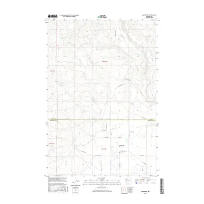
2017 Map of Glenwood
USGS Topo · Published 2017About this map
Glenwood serves as the focal point of this 2017 study, situated at the junction of the Trout Lake Hwy, B Z Glenwood Hwy, and Glenwood Hwy. The landscape is defined by its complex water management and natural drainage systems, including the Hellroaring Ditch and Sage Flat Ditch which parallel the winding Klickitat River to the east. Several named springs, such as McCumber Spring and Draper Springs, dot the terrain, illustrating the critical role of water sources in this part of Washington. The northern portion of the map is marked by the confluence of numerous creeks, including N Fork Dairy Cr, Bacon Cr, and Dairy Cr, which flow through the forested sections above the Yakima Co Klickitat Co line. Transportation routes like State St Regis Rd and Mount Adams Hwy provide access through the varying elevations of the Klickitat Valley.
Find a feature on this map
37 named features on this map. Tap any name to fly to it.
Don’t see what you’re looking for? This feature index may not catch every label — zoom into the map to look around manually.
Map Details
Editions of this 2017 Glenwood Map
This is the sole edition of this map. No revisions or reprints were ever made.
Other maps of this area

1904 · Mount Adams
USGS Topo · 1:125,000

1907 · Mount Adams
USGS Topo · 1:125,000

1934 · The Dalles
USGS Topo · 1:125,000

1950 · Yakima
USGS Topo · 1:250,000

1953 · The Dalles
USGS Topo · 1:250,000

1956 · The Dalles
USGS Topo · 1:250,000

1957 · The Dalles
USGS Topo · 1:250,000

1957 · Klickitat
USGS Topo · 1:62,500

1957 · Husum
USGS Topo · 1:62,500

1958 · Yakima
USGS Topo · 1:250,000