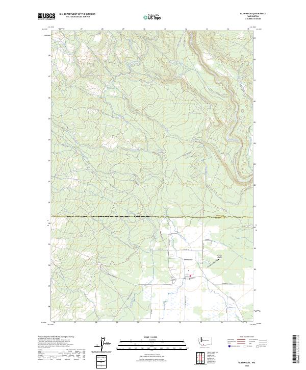
2023 Map of Glenwood
USGS Topo · Published 2023About this map
Glenwood serves as the central hub of this South Central Washington landscape, where the agricultural valley floor meets the rising timberlands near the Yakima Co Klickitat Co line. The settlement's street grid, including E Main St and B Z Glenwood Hwy, provides a focal point for the surrounding rural infrastructure. To the south, the Conboy Lake National Wildlife Refuge marks a significant conservation area in the Camas Prairie region. The map highlights a complex network of water management features essential to the local geography, such as the Hellroaring Ditch and the Stage Flat Ditch. Notable family-named landmarks and local sites like McCumber Spring, Draper Springs, and the Flying L Airport reflect the lived-in history of this high-plateau community, while the Klickitat River snakes through the eastern terrain.
Find a feature on this map
40 named features on this map. Tap any name to fly to it.
Don’t see what you’re looking for? This feature index may not catch every label — zoom into the map to look around manually.
Map Details
Editions of this 2023 Glenwood Map
This is the sole edition of this map. No revisions or reprints were ever made.
Other maps of this area

1904 · Mount Adams
USGS Topo · 1:125,000

1907 · Mount Adams
USGS Topo · 1:125,000

1934 · The Dalles
USGS Topo · 1:125,000

1950 · Yakima
USGS Topo · 1:250,000

1953 · The Dalles
USGS Topo · 1:250,000

1956 · The Dalles
USGS Topo · 1:250,000

1957 · The Dalles
USGS Topo · 1:250,000

1957 · Klickitat
USGS Topo · 1:62,500

1957 · Husum
USGS Topo · 1:62,500

1958 · Yakima
USGS Topo · 1:250,000