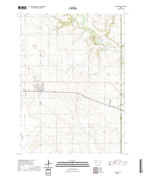
2022 Map of Glidden
USGS Topo · Published 2022About this map
The town of Glidden serves as a central hub on this West Central Iowa landscape, situated along a dense grid of streets including Arizona St, Dakota St, and Nevada St. To the east, the settlement of Ralston sits directly on the boundary between Carroll Co Greene Co, illustrating the region's structured township organization. The terrain is defined by a dendritic drainage pattern where waterways like Doe Brook, Willow Cr, and Purgatory Cr carve through the agricultural uplands toward the North Raccoon River in the northeast. This 2022 survey captures the modern alignment of rural transportation, showing how long-established section-line roads like Timber Ave and Sycamore Ave interface with modern infrastructure while maintaining the historical footprint of the Iowa prairie.
Find a feature on this map
56 named features on this map. Tap any name to fly to it.
Don’t see what you’re looking for? This feature index may not catch every label — zoom into the map to look around manually.
Map Details
Editions of this 2022 Glidden Map
This is the sole edition of this map. No revisions or reprints were ever made.
Other maps of this area

1954 · Omaha
USGS Topo · 1:250,000

1954 · Fort Dodge
USGS Topo · 1:250,000

1957 · Omaha
USGS Topo · 1:250,000

1957 · Fort Dodge
USGS Topo · 1:250,000

1958 · Omaha
USGS Topo · 1:250,000

1958 · Fort Dodge
USGS Topo · 1:250,000

1971 · Dedham
USGS Topo · 1:24,000

1971 · Coon Rapids NE
USGS Topo · 1:24,000

1971 · Coon Rapids North
USGS Topo · 1:24,000
1980 · Glidden
USGS Topo · 1:24,000