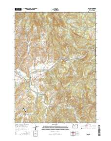
2014 Map of Glide
USGS Topo · Published 2014About this map
The North Umpqua River and Little River converge near the settlement of Glide, defining the geography of this Douglas County corridor. The presence of the Little River Log Pond and timber-access roads like Rock Creek RD and Hinkle Creek RD points to the area's deep-rooted logging economy. Small residential pockets and historical landmarks are scattered along the river valley, including the Wimberly Family Cem and the small communities of Idleyld Park and Peel.
Find a feature on this map
89 named features on this map. Tap any name to fly to it.
Don’t see what you’re looking for? This feature index may not catch every label — zoom into the map to look around manually.
Map Details
Editions of this 2014 Glide Map
This is the sole edition of this map. No revisions or reprints were ever made.
Other maps of this area

1897 · Roseburg
USGS Topo · 1:125,000

1900 · Roseburg
USGS Topo · 1:125,000

1954 · Dixonville
USGS Topo · 1:62,500

1954 · Glide
USGS Topo · 1:62,500

1955 · Red Butte
USGS Topo · 1:62,500

1955 · Mace Mtn
USGS Topo · 1:62,500

1958 · Roseburg
USGS Topo · 1:250,000

1959 · Roseburg
USGS Topo · 1:250,000

1978 · Diamond Lake
USGS Topo · 1:100,000

1979 · Roseburg
USGS Topo · 1:100,000