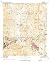
1945 Map of Globe
USGS Topo · Published 1974About this map
The copper-rich corridor of Globe and Miami dominates this mid-century survey, showcasing a landscape deeply transformed by industrial mining. Giant operations like the Inspiration Concentrator, International Smelter, and Miami Tailings Pond define the valley floor between the two settlements. This industrial density contrasts sharply with the ancient history preserved at the Bes H-Ba-Gowan Pueblo Ruins near Pinal Creek.
Find a feature on this map
70 named features on this map. Tap any name to fly to it.
Don’t see what you’re looking for? This feature index may not catch every label — zoom into the map to look around manually.
Map Details
Editions of this 1945 Globe Map
4 editions found
Other maps of this area

1901 · Globe
USGS Topo · 1:62,500

1902 · Globe
USGS Topo · 1:62,500

1922 · Chrysotile
USGS Topo · 1:125,000

1945 · Globe
USGS Topo · 1:24,000

1945 · Inspiration
USGS Topo · 1:24,000

1947 · Inspiration
USGS Topo · 1:24,000

1948 · Pinal Ranch
USGS Topo · 1:24,000

1949 · Pinal Ranch
USGS Topo · 1:24,000

1949 · Rockinstraw Mtn
USGS Topo · 1:62,500

1950 · Rockinstraw Mtn
USGS Topo · 1:62,500