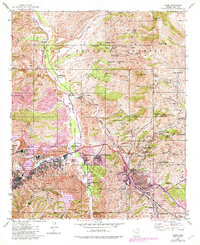
1945 Map of Globe
USGS Topo · Published 1982About this map
Industrial copper extraction dominates the landscape between Globe and Miami, where a dense network of mining infrastructure reflects the mid-century peak of the region's mineral economy. The map traces the massive operations of the Inspiration Concentrator and the International Smelter, with extensive Tailings deposits and ponds filling the valleys around Claypool. This industrial core is surrounded by several small residential developments, including Central Heights, Midland City, and Miami Gardens, which grew to support the workforce.
Find a feature on this map
83 named features on this map. Tap any name to fly to it.
Don’t see what you’re looking for? This feature index may not catch every label — zoom into the map to look around manually.
Map Details
Editions of this 1945 Globe Map
4 editions found
Other maps of this area

1901 · Globe
USGS Topo · 1:62,500

1902 · Globe
USGS Topo · 1:62,500

1922 · Chrysotile
USGS Topo · 1:125,000

1945 · Globe
USGS Topo · 1:24,000

1945 · Inspiration
USGS Topo · 1:24,000

1947 · Inspiration
USGS Topo · 1:24,000

1948 · Pinal Ranch
USGS Topo · 1:24,000

1949 · Pinal Ranch
USGS Topo · 1:24,000

1949 · Rockinstraw Mtn
USGS Topo · 1:62,500

1950 · Rockinstraw Mtn
USGS Topo · 1:62,500