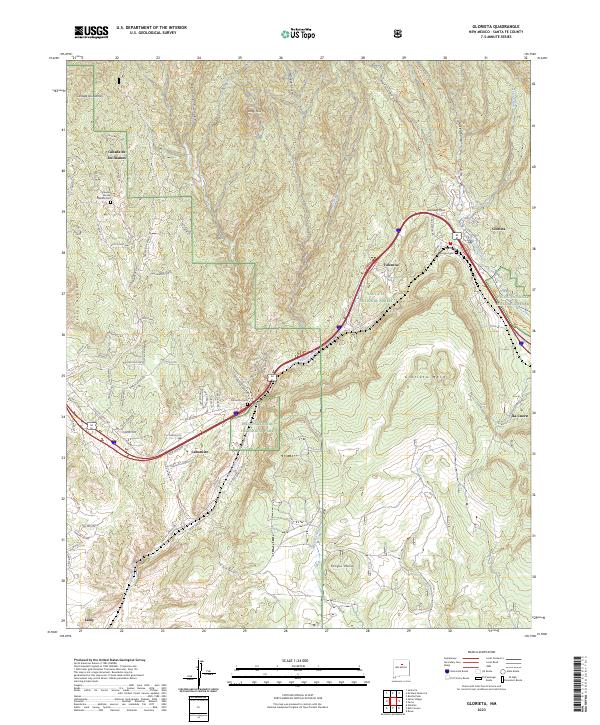
2023 Map of Glorieta
USGS Topo · Published 2023About this map
Glorieta Pass serves as the central focal point of this northern New Mexico landscape, marking a critical corridor between the Sangre de Cristo Mountains and the towering Glorieta Mesa. The area's settlement pattern is defined by clusters like Canoncito, Valencia, and Glorieta, which follow the natural geography of Galisteo Creek and the rail line. For genealogists, the map identifies specific burial sites including Canoncito Cem and the Canada de los Alamos Cem to the northwest.
Find a feature on this map
86 named features on this map. Tap any name to fly to it.
Don’t see what you’re looking for? This feature index may not catch every label — zoom into the map to look around manually.
Map Details
Editions of this 2023 Glorieta Map
This is the sole edition of this map. No revisions or reprints were ever made.
Other maps of this area

1889 · Santa Fe
USGS Topo · 1:125,000

1894 · Santa Fe
USGS Topo · 1:125,000

1894 · Lamy
USGS Topo · 1:125,000

1952 · Santa Fe
USGS Topo · 1:24,000

1952 · Seton Village
USGS Topo · 1:24,000

1953 · Glorieta
USGS Topo · 1:24,000

1953 · Mc Clure Reservoir
USGS Topo · 1:24,000

1954 · Santa Fe
USGS Topo · 1:250,000

1958 · Santa Fe
USGS Topo · 1:250,000
1961 · Santa Fe
USGS Topo · 1:24,000